

Interactive Earth app for iPhone and iPad
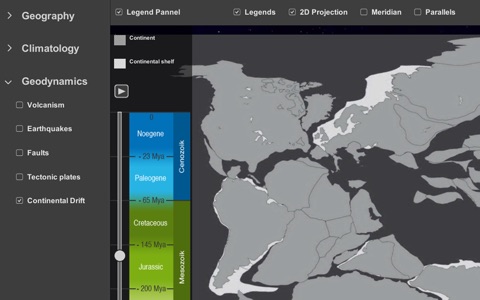
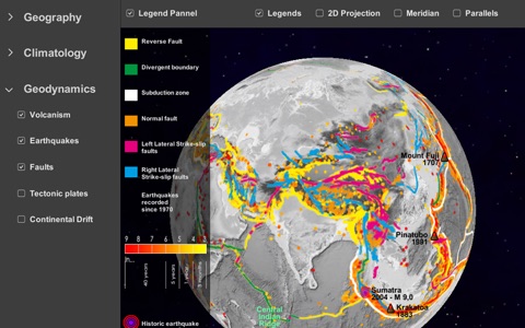
What did Earth look like 200 million years ago? Are Volcanoes and Earthquakes Related?
Interactive Earth is an interactive tool for tablet that allows you to explore geography, climates and geodynamics. This project would not have been possible without the expertise of IPGP (Institut de Physique du Globe de Paris) and NOAA (National Oceanic and Atmospheric Administration).
Interactive Earth is a great educational app that is fun to play and explore.
It allows you to superimpose composite images which show clouds, land and sea temperatures, or the global distribution of vegetation, snow and ice over the year.
Additional layers let you and your students explore plate tectonics, volcanoes, earthquakes, faults.
Switch from the 3D interactive view to the 2D map projection in one click.
Available maps:
•Geography: Topography, Oceans and Seas, Rivers and Lakes, Snow and ice(*), Vegetation(*), Deserts, Mountains
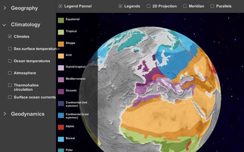
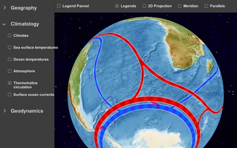
•Climatology: Climates, Continent temperatures(*), Sea surface temperatures(*), Atmosphere(*),Thermohaline circulation (*), surface ocean current
•Geodynamics: Volcanism, Earthquakes, Faults, Tectonic plates, Continental drift(*)
(*): Animated map